Project
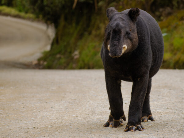
Mountain tapir conservation in Puracé National Park, Colombia
Initiative
Duration
2026
Location
Colombia
Species protected
Mountain tapir
Tapirus pinchaque
Project description
Mountain Tapir within Colombia’s Puracé National Park, focusing on understanding their population status, the impact of human-induced threats, and their ecological dynamics. Utilising a strategic sampling design, we will identify high-likelihood areas for tapir presence, employing GPS collars and automatic cameras to monitor tapir movements and behaviours, especially in relation to roads and human activities. The project will conduct systematic field surveys, analysing data through occupancy modeling to provide detailed insights into tapir distribution and habitat preferences.
Threats

Human-wildlife conflict
Project objectives
- Estimate the Mountain Tapir population status within Puracé National Park and surrounding area
- Analyse how road networks within the park affect Mountain Tapir movement and habitat utilisation.
- Understand the Mountain Tapir’s natural history, including dietary habits, habitat preferences, and ecological roles in the protected area.
Project activities
- Conduct habitat quality analysis to identify high-probability areas for tapir occurrence.
- Implement transect surveys across selected quadrants to collect data on tapir presence/absence.
- Analyse data using occupancy modelling to estimate population size and distribution patterns.
- Compile all field observations, GPS tracking data, and camera trap images into a unified dataset and document for analysis in a detailed occupancy model to illustrate Mountain Tapir distribution across Puracé National Park.
- Organise a workshop with Puracé National Park staff, involved local communities, and environmental authorities to share the occupancy model results, discussing Mountain Tapir distribution and collaborating on conservation strategies
- Install GPS collars on tapirs to monitor their movements around road areas.
- Conduct spatial analysis to correlate tapir movements with road locations
- Set up automatic cameras along major roads to observe number of tapirs related to roads and their behaviour.
This research project is implemented by Jorge Mario Becoche Mosquera, University of Cauca


